Garmin Navionics+ US & Coastal Canada • 010-C1287-20

Product Details
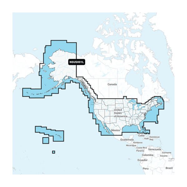
Featuring vibrant colours, a streamlined interface and combined coastal/inland content with a popular Navionics® style colour palette, Garmin Navionics+ cartography makes it easy to plot your course with the world"™s No. 1 name in marine mapping. Detailed coverage of the entire U.S. coasts, lakes, rivers and inland waterways, plus Alaska and Hawaii. Canada coverage of coastal British Columbia, the Great Lakes, the St. Lawrence Seaway, New Brunswick and Nova Scotia. Coverage includes Bermuda, the Bahamas, Baja California, the Gulf of California, Johnston Atoll and Palmyra Atoll/Kingman Reef.
- Navigate With The Best Offshore And Inland Lake Coverage For Your Garmin Chartplotter
- Customize Your View With Various Chart Layers And Overlay Combinations
- Auto Guidance+™ Technology2 Lets You Navigate With Suggested Dock-To-Dock Routings
- Access Detail-Rich Mapping Of Coastal Features, Lakes, Rivers And More
- Integrated Garmin And Navionics® Content Offers Coverage For Boaters Worldwide
- Built-In Auto Guidance+ Technology2 Gives You A Suggested Dock-To-Dock Path To Follow Through Channels, Inlets, Marina Entrances And More
- To Give A Clear Picture Of Shallow Waters To Avoid, This Feature Allows For Shading At A User-Defined Depth
- Select up to 10 color-shaded target depth ranges to scope out the best fishing spots
$183.99
in stock
Quantity
