Garmin Navionics+ Vision+ Canada & Alaska Chart • 010-C1288-00

Product Details
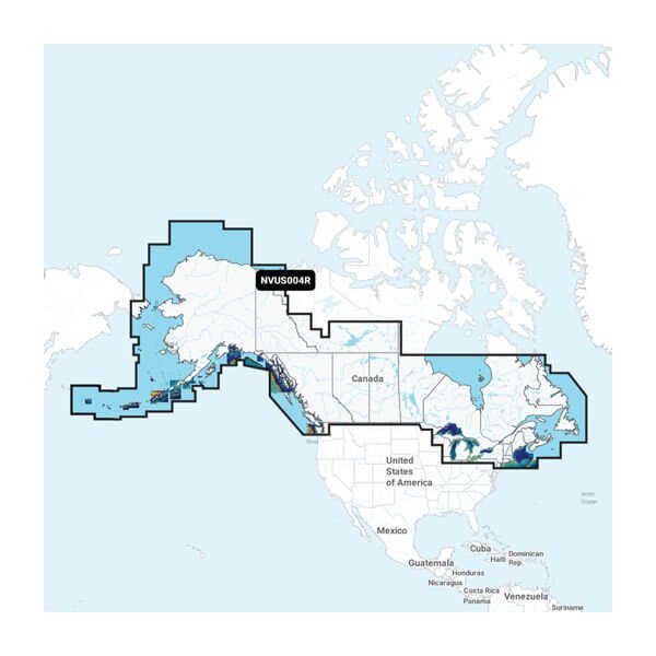
Featuring vibrant colours, a streamlined interface and combined coastal/inland content with a popular Navionics® style colour palette, Garmin Navionics+ cartography makes it easy to plot your course with the world"™s No. 1 name in marine mapping. Detailed coverage of the Atlantic and Pacific coasts, inland lakes and waterways of Alaska and Canada (except YT and NU). Coverage includes the Aleutian Islands, Vancouver Island, Puget Sound, the St Lawrence River, the Maritime Provinces and the Grand Banks.
- Navigate With The Best Offshore And Inland Lake Coverage For Your Garmin Chartplotter
- Customize Your View With Various Chart Layers And Overlay Combinations
- Auto Guidance+™ Technology2 Lets You Navigate With Suggested Dock-To-Dock Routings
- Access Detail-Rich Mapping Of Coastal Features, Lakes, Rivers And More
- Integrated Garmin And Navionics® Content Offers Coverage For Boaters Worldwide
- Built-In Auto Guidance+ Technology2 Gives You A Suggested Dock-To-Dock Path To Follow Through Channels, Inlets, Marina Entrances And More
- To Give A Clear Picture Of Shallow Waters To Avoid, This Feature Allows For Shading At A User-Defined Depth
- Compatibility: Garmin GPS Navigation Systems/ Chart Plotters
- Chart Coverage: Detailed Coverage Of Atlantic And Pacific Coasts, Inland Lakes And Waterways Of Alaska And Canada
- Storage: On SD/ Micro-SD Card
- No returns if package is opened
$226.99
Out of Stock
