Garmin Navionics+ Vision+ US South • 010-C1290-00

Navigate With The Best Offshore And Inland Lake Coverage For Your Garmin Chartplotter
Customize Your View With Various Chart Layers And Overlay Combinations
Auto Guidance+™ Technology2 Lets You Navigate With Suggested Dock-To-Dock Routings
Access Detail-Rich Mapping Of Coastal Features, Lakes, Rivers And More
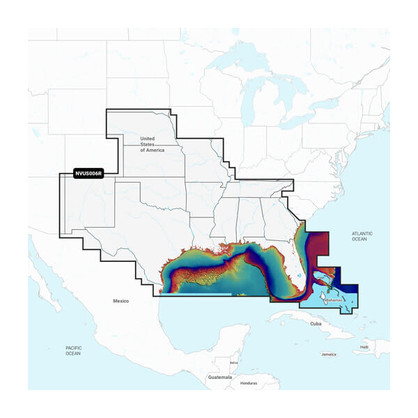
Integrated Garmin And Navionics® Content Offers Coverage For Boaters Worldwide
Built-In Auto Guidance+ Technology2 Gives You A Suggested Dock-To-Dock Path To Follow Through Channels, Inlets, Marina Entrances And More
To Give A Clear Picture Of Shallow Waters To Avoid, This Feature Allows For Shading At A User-Defined Depth
Select up to 10 color-shaded target depth ranges to scope out the best fishing spots
Opened packaging can not be returned
All-In-One Map Solution for Garmin Chartplotters - Access detail-rich mapping of coastal features, lakes, rivers and more. Integrated Garmin and Navionics content offers coverage for boaters worldwide.
Daily Chart Updates - Charts are constantly being enhanced with new and amended content "” as many as 5,000 updates are made every day. The one-year included subscription gives you access to daily chart updates via the ActiveCaptain smart device app.
Auto Guidance+ Technology - Combining the best of Garmin and Navionics automatic routing features, built-in Auto Guidance+ technology gives you a suggested dock-to-dock path to follow through channels, inlets, marina entrances and more.
Depth Range Shading - High-resolution depth range shading lets you select up to 10 colour-shaded options and view your designated target depths at a glance.
Up to 0.5 M Contours - For improved fishing and navigation, up to 0.5 m contours provide a clear depiction of bottom structure for improved fishing charts and enhanced detail in swamps, canals, harbours, marinas and more.
Shallow Water ShadingTo give a clear picture of shallow waters to avoid, this feature allows for shading at a user-defined depth.
Activecaptain Community - Community-sourced content provides useful POIs, such as marinas, anchorages, hazards, businesses and more. Get recommendations from boaters with firsthand experience of the local environment.
Relief Shading - This detailed shading feature combines colour and shadow to give you an easy-to-interpret, clearer view of bottom structure than contour lines alone.
High-Resolution Satellite Imagery - High-resolution satellite imagery provides superior situational awareness.
Aerial Photography - Crystal-clear aerial and surface photos of ports, marinas, bridges, docks, boat ramps, dams and navigational landmarks provide a better sense of your surroundings above the waterline.
3D Fisheye View - This underwater perspective shows 3D representation of bottom and contours as seen from below the waterline. Interface with sonar data for a customised view.
3D Marinereye View - This view provides a 3D representation of the surrounding area both above and below the waterline.
Dynamic Lake Level - Adjust your maps to the lake"™s current water levels to see if spots are accessible or too shallow to explore.
