Navionics+ U.S. East • 010-C1370-30
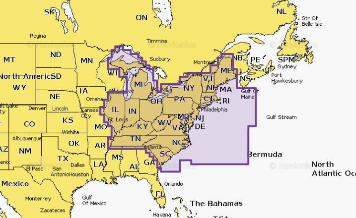

Detailed coverage of the lakes, rivers and coasts of Connecticut, Delaware, Illinois, Indiana, Kentucky, Maine, Maryland, Massachusetts, Michigan, New Hampshire, New Jersey, New York, North Carolina, Ohio, Pennsylvania, Rhode Island, South Carolina, Tennessee, Vermont, Virginia and West Virginia. Get both saltwater and freshwater charts throughout the entire region. Nautical Chart is preloaded. SonarChart™ 1' HD bathymetry maps and Community Edits can be downloaded along with daily updates for one year! Simply plug your card into your PC/Mac to get the most updated charts.
Opened packages will not be eligible for credit return
Not compatible with Garmin devices
Coastal Content
Inland Content: 44,000+ Lakes
Detailed Nautical Charts
Daily Updates
Dock-to-Dock Route Guidance
Plotter Sync
Community Edits
Advanced Map Options
SonarChartTM Live Mapping
